Bras Basah In Early Maps, Paintings and Postcards
Explore the rich history of Bras Basah through early maps, postcards, and paintings that trace its growth from a quiet suburb into one of Singapore's most storied districts
Last updated on 25 August 2026
Early Bras Basah In Maps
Bras Basah is one of the oldest districts in Singapore. Situated within the European part of Stamford Raffles’s 1822 plan for the town of Singapore (also known as the Raffles Town Plan), it served as the suburb just outside of Commercial Square (now known as Raffles Place). Over the next two centuries, Bras Basah would flourish: schools were established, religious buildings and some of the finest colonial structures in Singapore were constructed.
The development of Bras Basah during its early days is recorded in the Maps Collection at the National Archives of Singapore. Witness its progress by scrolling through some of the maps below. You can also compare the changes by clicking on past maps and overlap them with the present one using our Spatial Discovery (opens in new tab) platform.
The road was so-called because in the early days, wet rice was laid to dry here on the banks of the "fresh water stream" (now the Stamford Canal). Another version is that before the area between Bras Basah Road and Stamford was filled in, cargoes of rice were brought by boats into the lagoon and spread to dry on the road. On one occasion, high tides wet the rice.— Bras Basah” is a misspelling of “beras basah”, which means “wet rice” in Malay as explained in Victor Savage’s and Brenda Yeoh’s explanation in Singapore Street Names: A Study of Toponymics (2013) (Call no.: RSING 915.9570014 SAV)
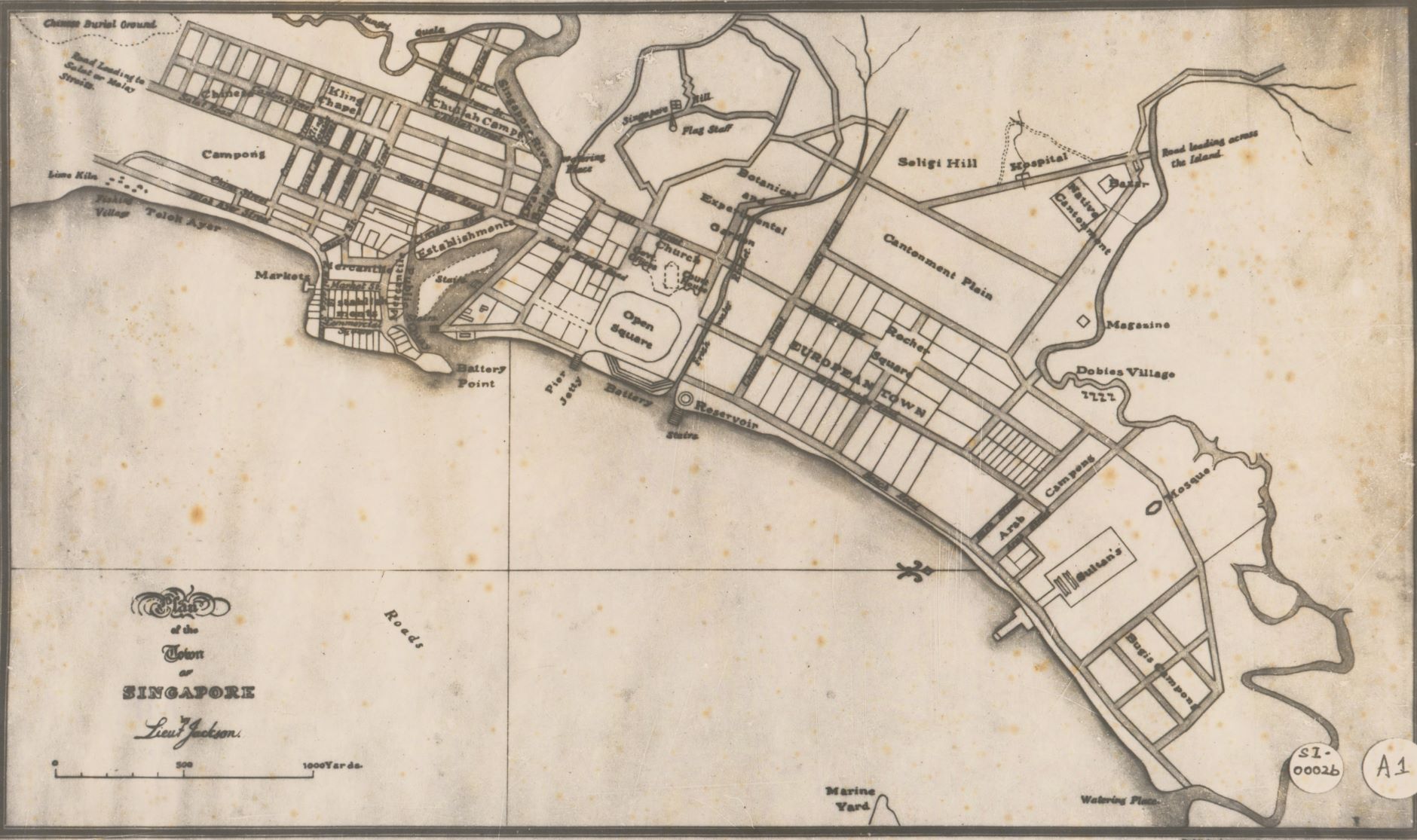
This is the Plan of the Town of Singapore by Lt. Philip Jackson. Also known as Raffles Town Plan or Jackson Plan, it was published in 1828. Besides showing the location of the ethnic enclaves that Raffles envisioned with the Town Planning Committee in 1822, the map also noted that Bras Basah Road was initially known as Church Street and Selegy Street. (Image Credit: Survey Department, Courtesy of National Archives of Singapore (opens in new tab))
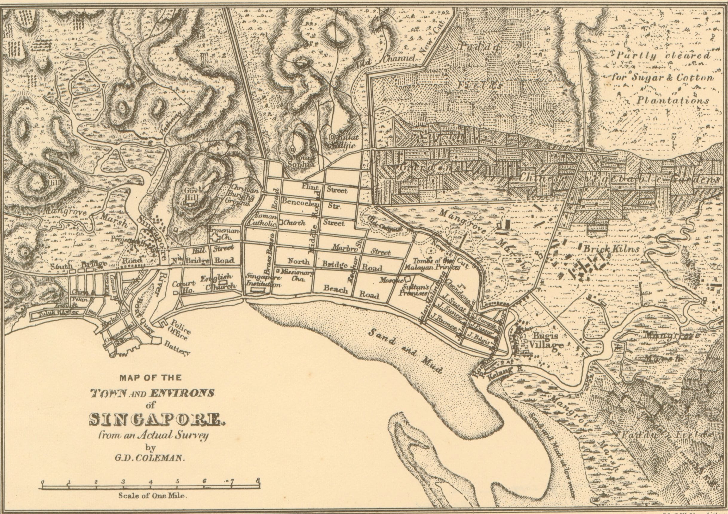
This 1839 map was one of the earliest survey maps of Singapore. Prepared by George Coleman, Bras Basah Road is labelled as “Bras Bassa Road”. Also visible are the former grounds of Raffles Institution and a handful of churches including St Joseph’s, St Andrew’s and the Armenian Church. (Image Credit: Courtesy of National Archives of Singapore (opens in new tab))
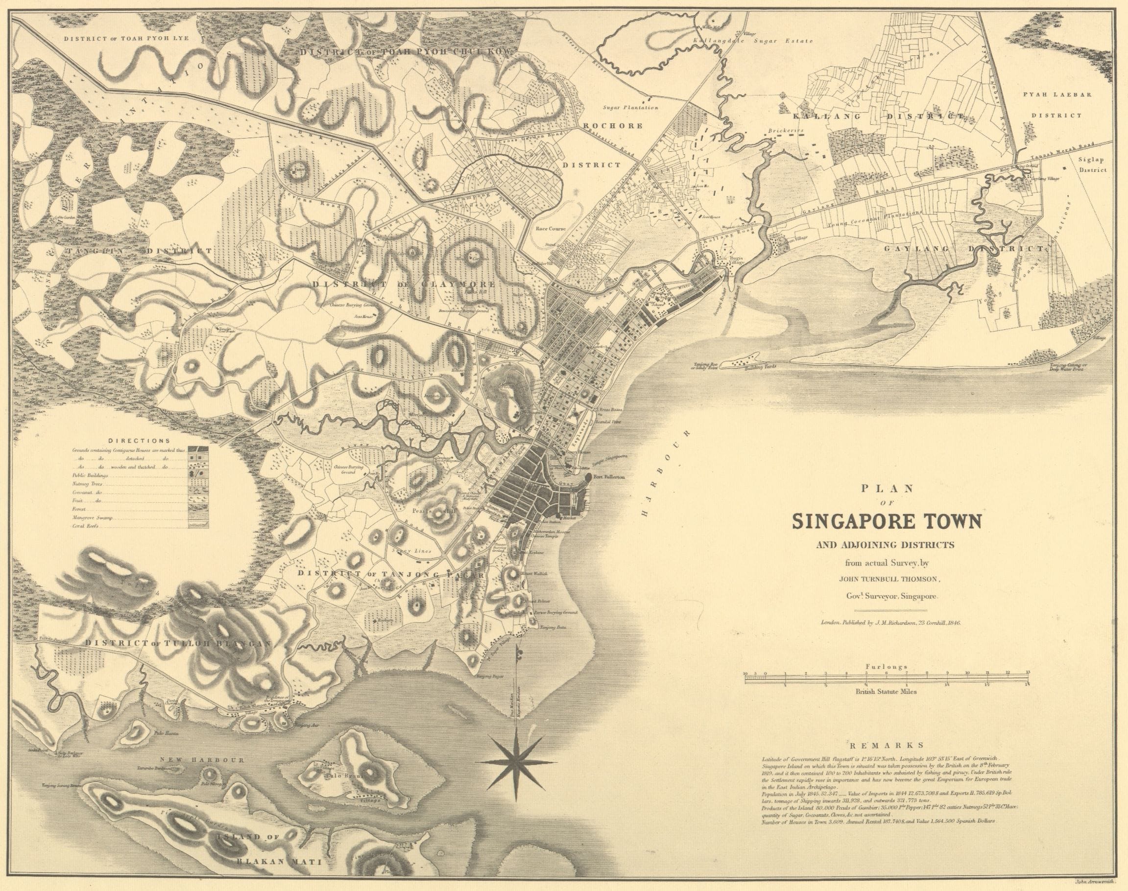
By the mid-1800s, Bras Basah was already a busy area with rows of shophouses and roads crisscrossing the district. This can be seen in this 1846 survey map prepared by John Turnbull Thomson. (Image Credit: Courtesy of National Archives of Singapore (opens in new tab))
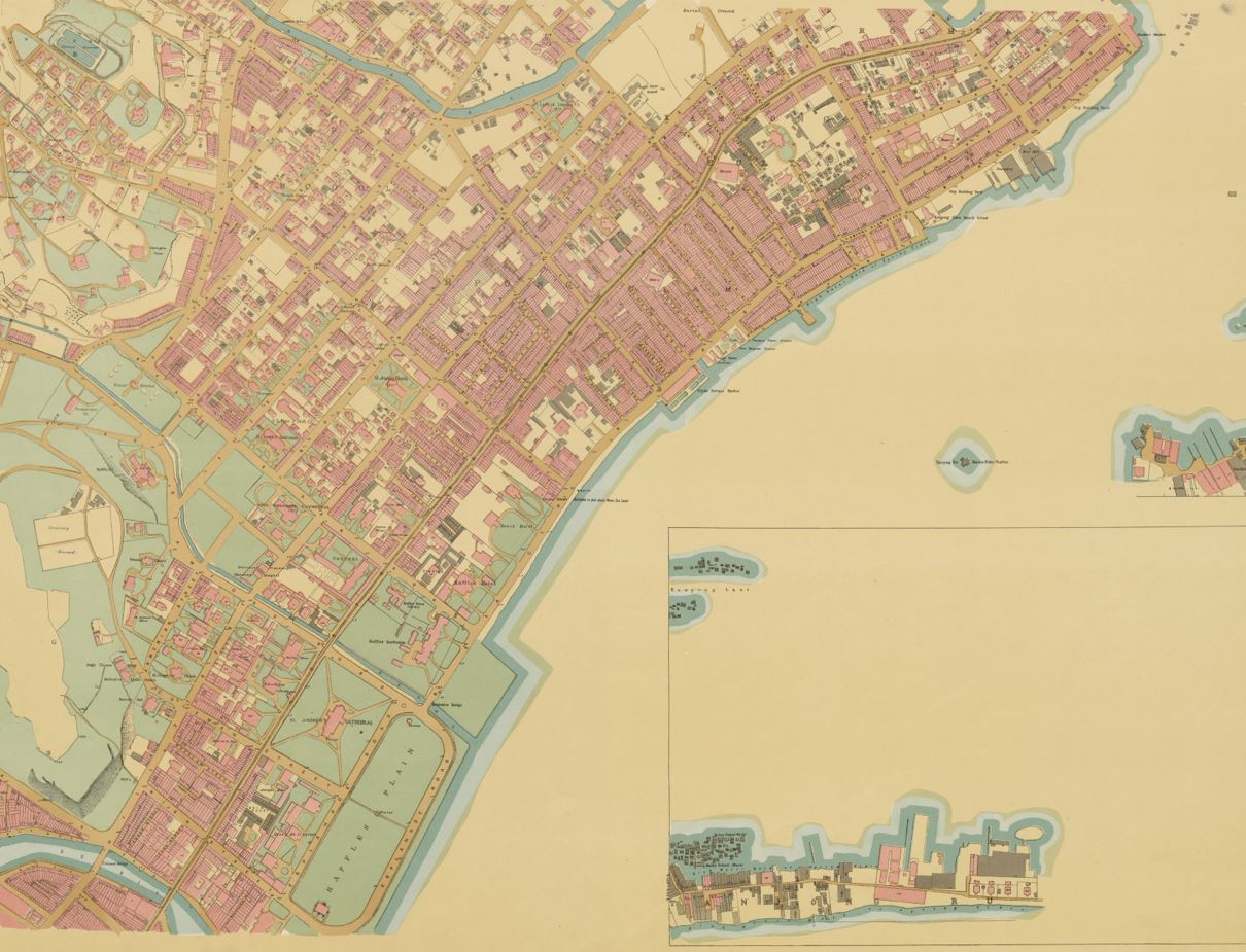
From the 1890s, surveyors began to spell “Bras Basah Road” as we know it today. This 1893 map is among the earliest that carried out this change. (Image Credit: Hon Sui Sen Collection, Courtesy of National Archives of Singapore (opens in new tab))
The new enamelled street signs being put up by the Municipality are blue on white, instead of the old white on blue...The spelling seems to have received some attention, the "Bras Bassa Road" becomes "Bras Basah Road". The latter gives some indication of the meaning of the name and send thoughts back to the padi fields that at one time occupied the valley stretching from Fort Canning eastward.— An 1899 issue of The Straits Times explaining why “Bras Bassa” was relabelled “Bras Basah” in the maps of Singapore from the 1890s. (Source: The Straits Times via NewspaperSG)
Early Bras Basah in Prints and Paintings
During the 19th century, much of Singapore’s early growth and progress, including those in Bras Basah, was recorded in topographical prints. Usually published in the accounts of scientific voyages, travel books or bound folios, they form a historically significant and visually pleasing source of information on the settlement’s history. Below are a selected few but more could be found in publications produced by the National Museum of Singapore as well as its collection made available in Roots (opens in new tab).
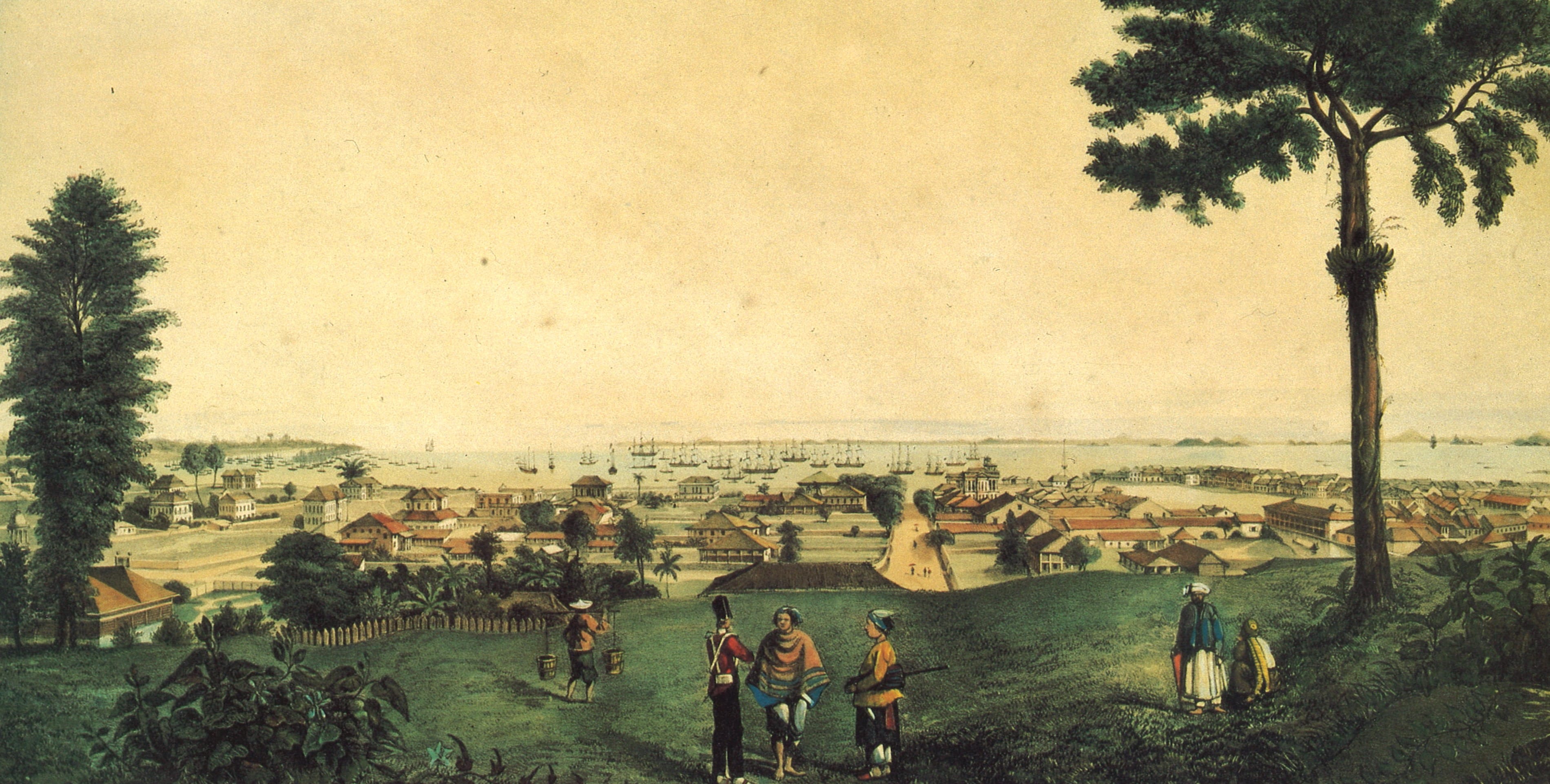
This 1837 lithograph, “View of Singapore from Government Hill”, by W. C. Smith shows the development of the town by the mid-1830s. On the left are buildings in Bras Basah which include the Armenian Church, Raffles Institution and St Andrew’s Church. (Image Source: Singapore Through 19th Century Prints & Paintings (opens in new tab))
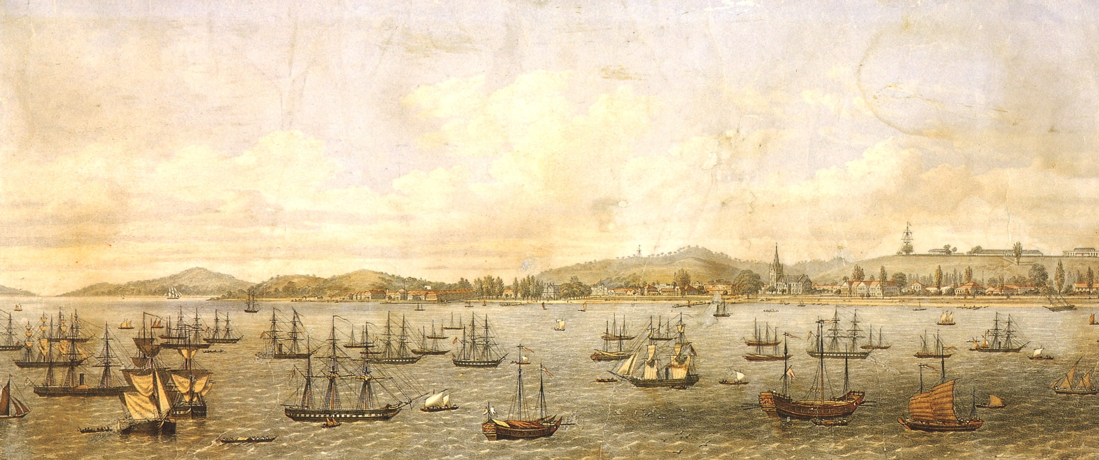
This 1861 coloured lithograph by W. Gray provides a panoramic view of the town as seen from the harbour, from Telok Blangah on the left to Beach Road on the right. Buildings including St Andrew’s Cathedral, Raffles Institution and others like the Court House can all be seen clearly. (Image Source: Singapore Through 19th Century Prints & Paintings (opens in new tab))
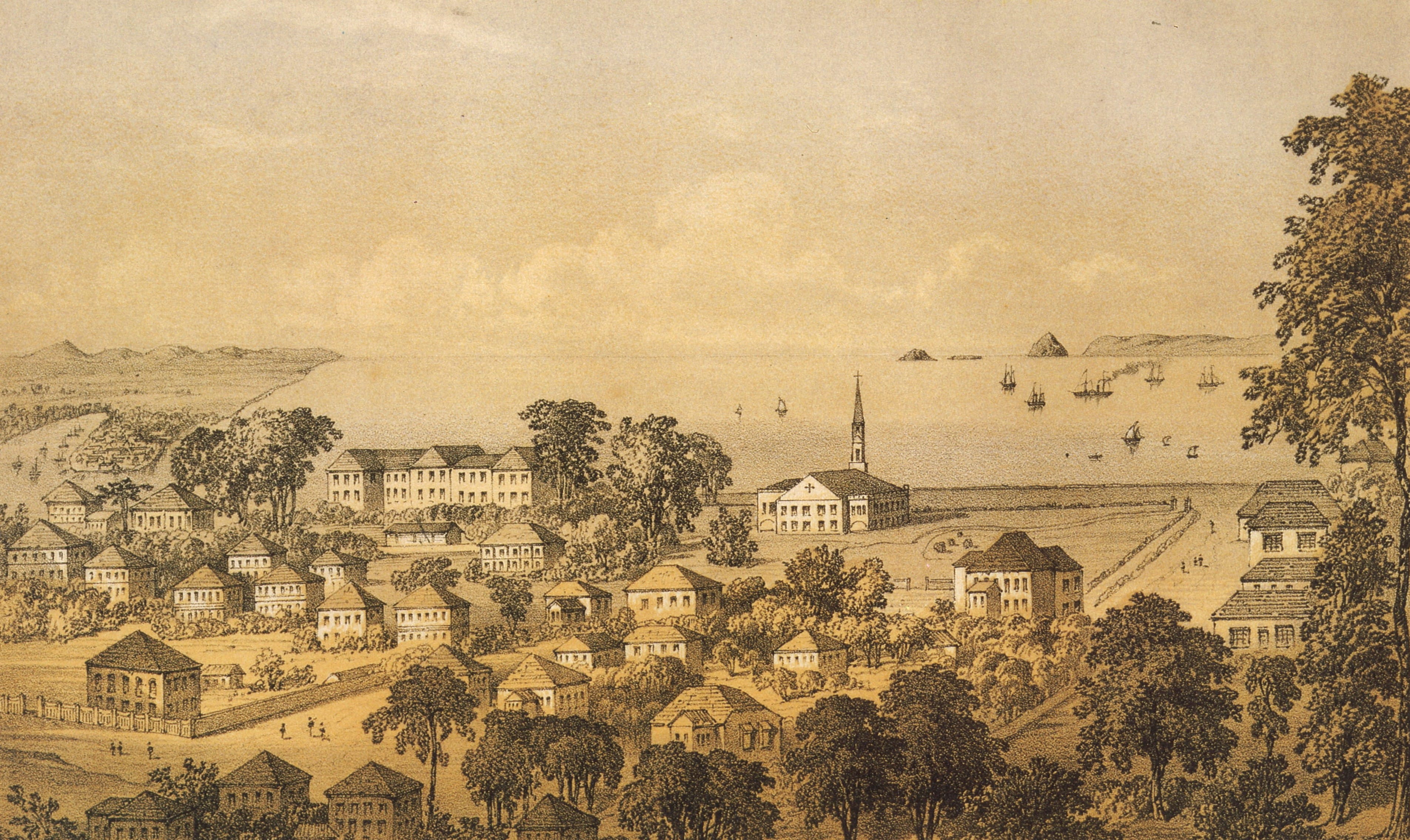
This 1852 tinted lithograph by Charles Walker Kinloch provides one of the clearest views of Bras Basah at the time including buildings such as St Andrew’s Church and Raffles Institution. (Image Source: Singapore Through 19th Century Prints & Paintings (opens in new tab))
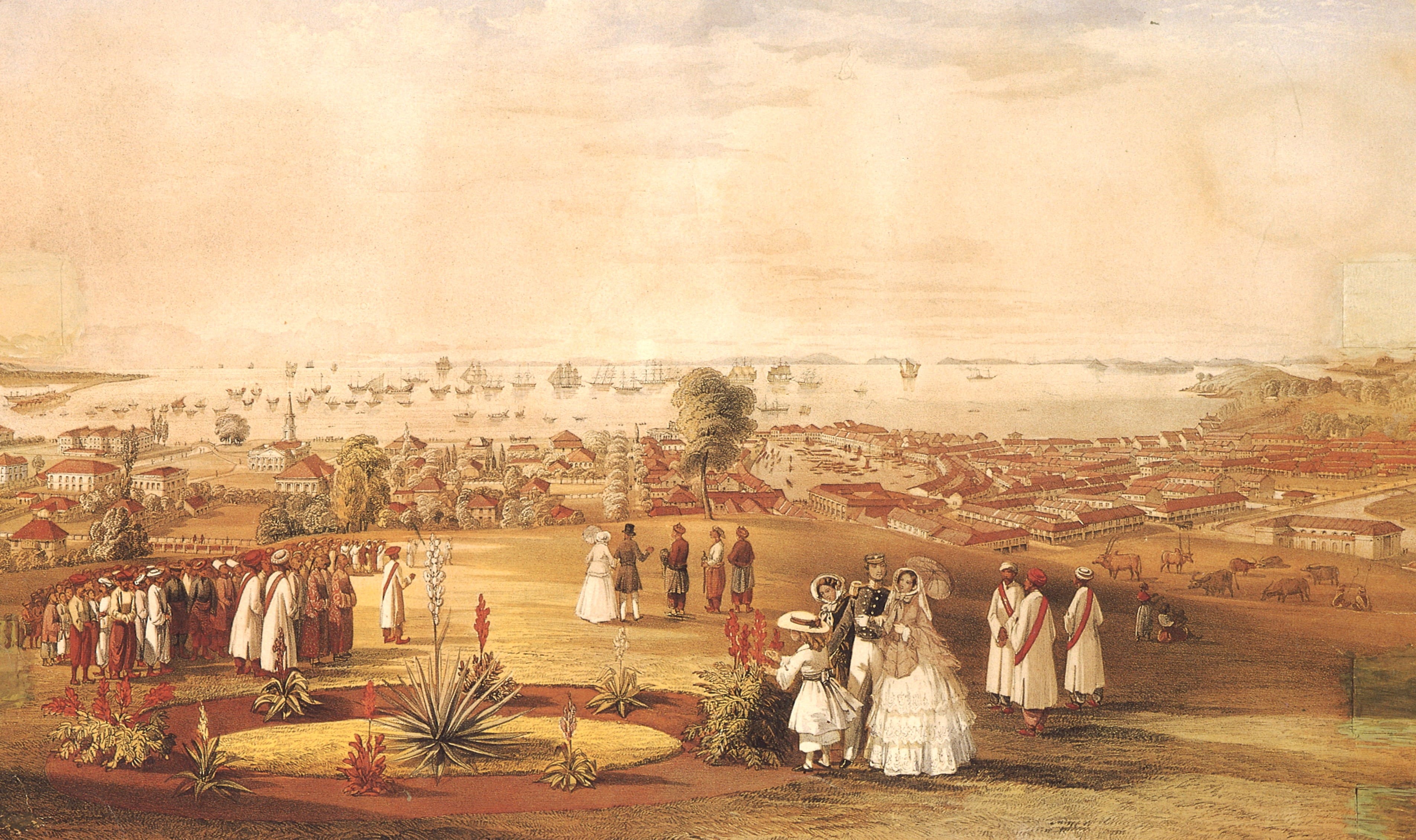
This 1846 coloured lithograph by John Turnbull Thomson is known for its accurate portrayal of the town including Bras Basah (left). The buildings that can be seen are Raffles Institution and St Andrew’s Church. (Image Source: Singapore Through 19th Century Prints & Paintings (opens in new tab))
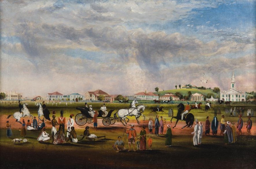
This 1851 oil painting is also by John Turnbull Thomson. It shows a view of the Padang from Scandal Point, the Saluting Battery situated at the edge of Connaught Drive, southeast of St Andrew’s Church whose spiral can be seen at the far right. (Image Credit: Courtesy of the National Museum of Singapore, National Heritage Board (opens in new tab))
Early Bras Basah in Postcards
The first postcard in the Straits Settlements was issued in 1879. However, it was not only until the late 1890s when the British postal authorities allowed privately printed postcards to be despatched at the same inexpensive postal rate as government issued ones that pictures began to appear on the otherwise blank postcards. Picture postcards showing local views and landscapes of Singapore quickly gained popularity. Today, these postcards, which can be found in the collections of the National Archives of Singapore and National Museum of Singapore, paint an invaluable picture of the past.
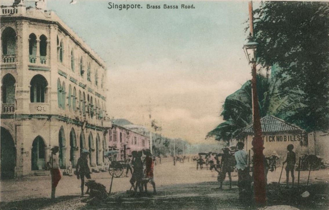
This postcard from the early 1900s shows the junction of Bras Basah Road and Bencoolen Street, where the remains of the administrative block of the former Convict Gaol can be seen on the right. (Image Credit: Courtesy of the National Museum of Singapore, National Heritage Board (opens in new tab))
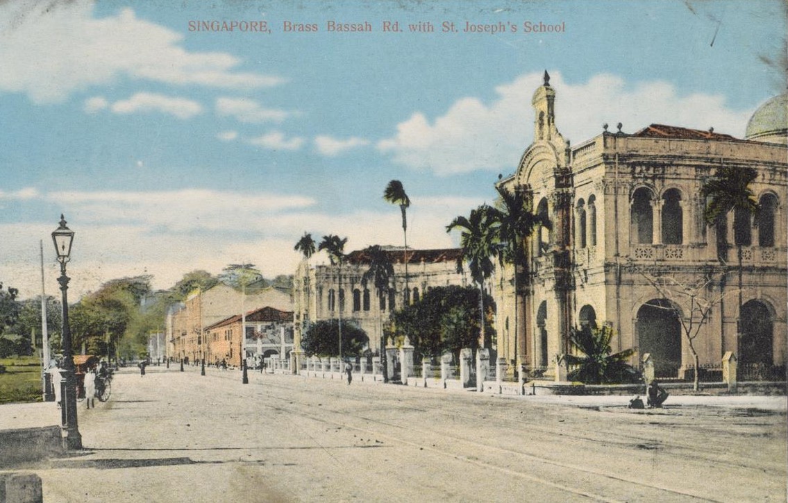
This is another postcard from the same period that shows St Joseph’s Institution (SJI) at Bras Basah Road in the early 1900s. SJI was an English medium school for boys established by the Brothers of the Christian Schools, a teaching order under the aegis of the De LaSalle Brothers. (Image Credit: Courtesy of the National Museum of Singapore, National Heritage Board (opens in new tab))
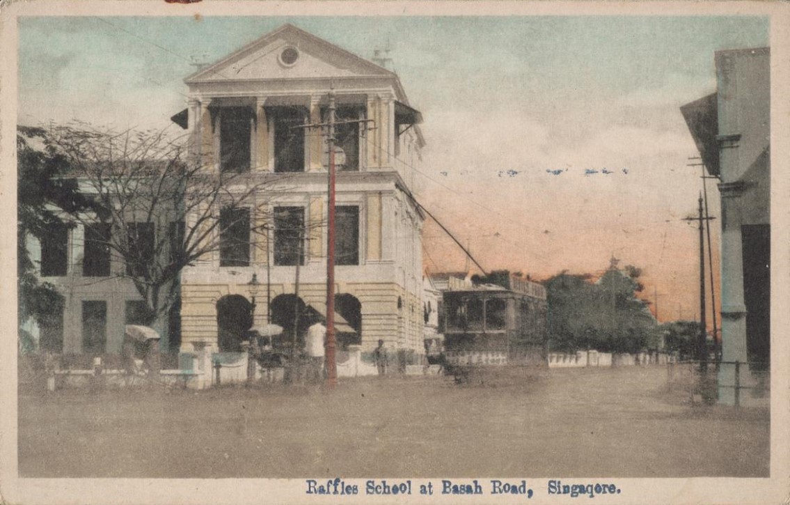
Originally known as the Singapore Institution, Raffles Institution was originally located in Bras Basah as shown in this early 1900s postcard from the collection of the National Museum of Singapore. (Image Credit: Courtesy of the National Museum of Singapore, National Heritage Board (opens in new tab))
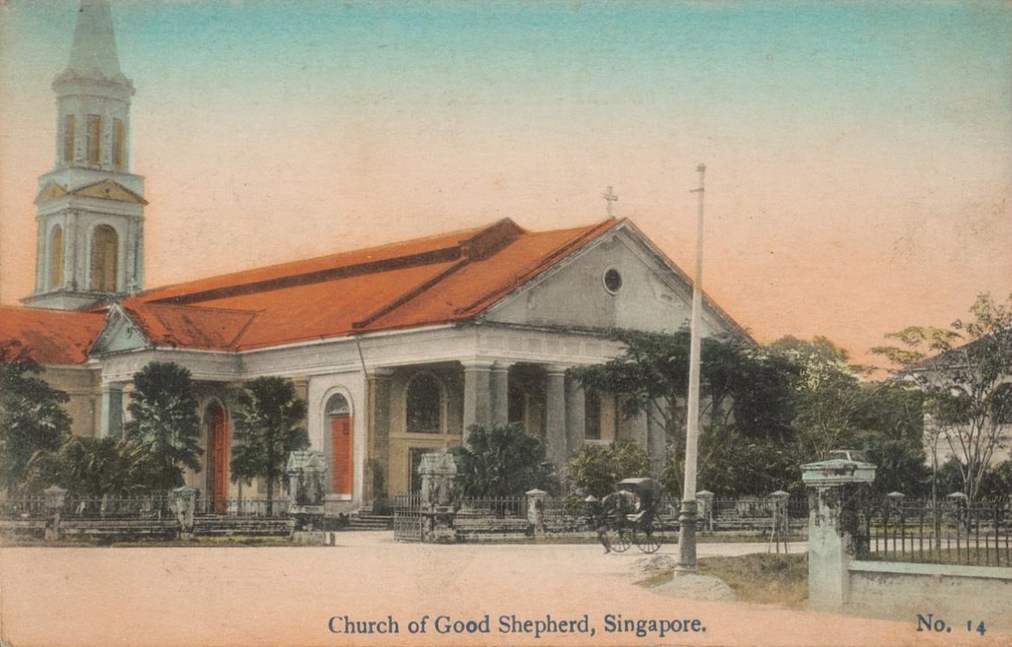
With a history that dates back to 1843, the Church of Good Shepherd, shown in this postcard, is the oldest Roman Catholic church in Singapore. (Image Credit: Courtesy of the National Museum of Singapore, National Heritage Board (opens in new tab))
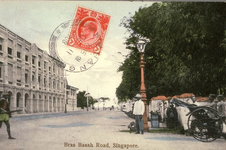
This early 1900s postcard from the collection of the National Archives of Singapore shows a stretch of Bras Basah Road towards the seafront. (Image Credit: Courtesy of National Archives of Singapore (opens in new tab))
Lambert has maintained a high reputation for artistic portraiture, and of landscapes they have one of the finest collections in the East, comprising about three thousand subjects relating to Siam, Singapore, Borneo, Malaya and China. An extensive trade is done in picture postcards, the turnover being about a quarter million cards a year. A large stock of apparatus is always kept in hand.— The postcard industry was a very profitable business in Singapore during the early 1900s with many well-known photography studios including G.R. Lambert & Co. engaging in it as described in Twentieth Century Impressions of British Malaya (1908). (Call no.: RDTYS 959.52033 TWE)
Bras Basah and Its Places of Worship
The history of Bras Basah and its vicinity can also be told through the places of worship that can be found in the district.